A company is trying to map America’s cell networks using mail trucks
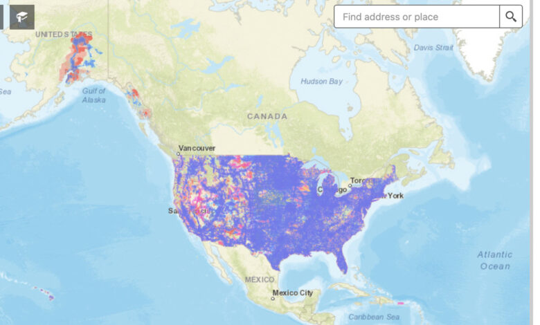
Pictured: the FCC’s map of LTE coverage in the US. | Image: FCC
Cell network coverage maps have always been dubiously accurate in the US, and even the ones released by the FCC in 2021 come with a ton of asterisks. A company called Ranlytics is hoping to make a much more accurate picture by attaching equipment to some of the mail trucks that are already driving to most addresses in the US to deliver parcels and letters.
In a press release earlier this week, Ranlytics says it’s working with the US Postal Service to measure AT&T, T-Mobile, and Verizon’s 4G and 5G networks in Seattle and that it’s already producing “the most detailed available” coverage maps for select areas in the city. (It says the equipment it uses is also capable of mapping 3G networks, but those are largely gone in the US.) The…